Transform CommandDifficultyintermediateAdded2027.0StatusdraftConvert Point File Command
Description:
Converts points text file between two coordinate systems defined in Civil 3D (Map 3D). The coordinate system definitions and transformation definition must already exist in Civil 3D. The resulting text file can then be imported into Civil 3D as points or a surface, or it can be used in other programs that can read XYZ point files.
Location on Compact Ribbon:
Location on Extended Ribbon:
Instructions:
-
Run the command.
-
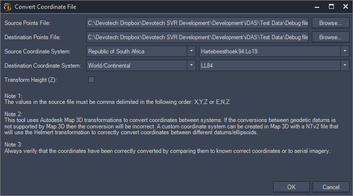
In the dialog choose the points file that you want to convert:
-
Choose a destination for the converted file.
-
Choose the source and destination coordinate systems.
-
Check the Transform Height option if you want to also transform the Z elevations (this will only work if there is a transformation definition defined).
-
Read all the notes to ensure you file format is correct and to understand the limitations of the command.
-
Click the OK button and the transformed file will be created.