Import ModelMaker TOT CommandDifficultyintermediateAdded2027.0StatusdraftImport TOT Command
Description:
Imports a ModelMaker Total (TOT) file.
Location on Compact Ribbon:
Location on Extended Ribbon:
Instructions:
In South Africa surveyors often provide designers with surface data in a .tot file format. To convert these files into an Autodesk Civil 3D surface, follow these steps:
-
-
Run the command.
-
Browse to the .tot file. The file name must not contain special characters like: &,~,° etc., otherwise the import will fail.
-
Specify the Surface Name and choose the options you want to apply:
-
-
Ignore 1st Line in TOT File – use this option if the first line (row) does not contain point description information and coordinates (Y, X, Z):
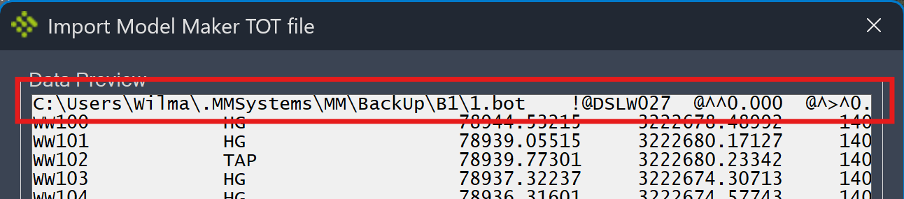
This option must also be used if the first two columns contain the same coordinates:
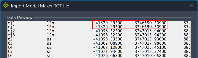
-
Swap YX columns – select this option if you know that the Y and X coordinates must be swapped or if the created surface is rotated.
-
Apply South African Coordinate Translation – if you know that the data needs to be rotated to the third quadrant, it can be done automatically by selecting this option.
-
Import Points as COGO Points – if you want to create COGO points from the .tot file, select this option. This can be useful to display points for certain objects (edge of road, centreline, Manholes etc.).
-
Do NOT Create Surface ‒ if COGO points need to be created but not a surface, select this option with option d).
-
Use first column as point numbers – select this option if you want to import points as COGO points using numbers from the first column.
- Once you click OK, the LandXML file for the surface is created in the location of the .tot file and it is automatically imported into Civil 3D. The default surface style is Grid:
Troubleshooting
If the Import TOT command fails to import a .tot file, try to move the .tot file to your Desktop and import it again. If it solves the problem, then the issue was caused by having insufficient privileges to write to the original .tot file location.