Rotate Objects CommandDifficultyintermediateAdded2027.0StatusdraftSA Coordinates Command
Description:
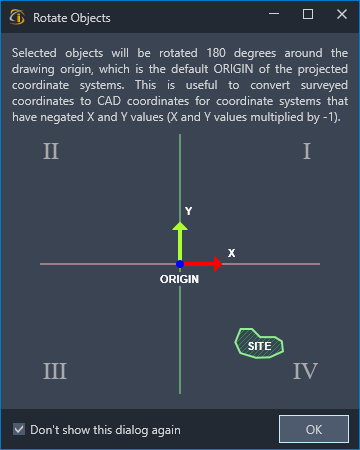
Rotates objects 180 degrees around the drawing origin.
Location on Compact Ribbon:
Location on Extended Ribbon:
Instructions:
If objects in your drawing (e.g. surface) is in the wrong quadrant of the coordinate system, you should apply the rotation. This is useful for coordinate systems that are southern facing.
In South Africa, surveying is done on a local coordinate system that is positioned at 2-degree bands. If you have a coordinate (10, 20) in a local coordinate system, the point will be plotted in the third quadrant. (Bottom-left position on the grid). If we plot the same point in the World coordinate, the point will be plotted in the first quadrant. (Top-right)
If we import survey data into a CAD system, the data will be in the first quadrant instead of the third quadrant. In other words, the north direction of our survey, is now actually pointing south. To fix this problem, we can either mirror the data around the 45-degree axis, or alternatively, we can swap the X and Y values, and multiply both with (-1).
This above can be achieved by using this command.
 Always confirm the orientation of your data with other maps, plans or cadastral data to ensure that your data is displayed in the correct quadrant.
- Run the command.
- Select the objects and right-click to finish the selection.
Before After
-
Alternatively, choose the Hint option before selecting objects to get an explanation of how the command functions.